Relation between Field Test, Soil Profile and Borehole
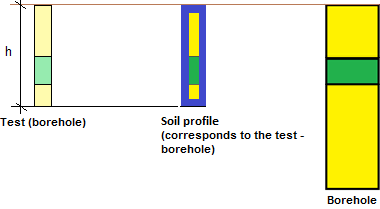
The soil profile is created from the test (exploration point), and the borehole is created from the soil profile. It is not possible to edit coordinates of the soil profile and borehole - they always correspond to the coordinates of the test.
If the type of the test is a borehole, the Soil profile is created automatically, hovewer, for the creation of a 3D model, it is usually necessary to simplify it.
 Relationship between the Soil Profile and Test (Borehole)
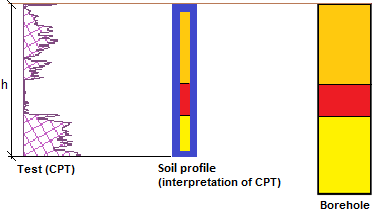
If the type of test is not a borehole, it is necessary to transfer this test into the soil profile (thickness of layers and assigned soils).
 Relationship between Soil Profile and Test (Borehole)
Interpretation of field test into a soil profile can be carried out when modeling geological sections.
During this process, the soil profiles can be directly created or edited.
If the data of field tests are changed, the soil profile is also changed automatically. If the soil profile is changed, the borehole is also changed, and it leads to the change of the entire geological model.